Staging clarity
Fewer conflicts between apparatus placement and pedestrian access when you know which approach supports the equipment the incident needs.
Get in touch hello@happypath.no
Emergency services
GPS delivers you to the map. The operation happens at the gate, in the stairwell, and at the door that actually opens. Every hesitation, split crew, or backtrack pays its price in time — not in meters.
Happypath captures the practical arrival layer — approach points, entrances, paths, and access detail — so crews can orient themselves before the first boot is on the ground.
Staging, primary entry, and vertical access when the working side of the building isn’t the street front.
Jump to section →PoliceClear, discreet approach options and entrance detail for time-sensitive or sensitive calls.
Jump to section →Ambulance & EMSFast patient access: elevators, barriers, and the shortest route from curb to bedside.
Jump to section →Fire & rescue
Large buildings, industrial sites, and campuses usually have a working arrival point that isn’t the visitor address. Engines stage where hydrants, turning radius, and ladder placement allow — not where the postal centroid happens to sit.
Pain: time lost guessing which side of the structure is the primary entry for this incident type, or which gate leads to the yard that actually connects to the relevant stairwell.
Happypath: structured approach and entrance data with path context, so the first officer can brief the approach before wheels stop, and every follow-on unit reads the same plan without extra radio traffic.
Fewer conflicts between apparatus placement and pedestrian access when you know which approach supports the equipment the incident needs.
When every arriving unit reads the same entrance and path, radio traffic drops and the first minutes go to tactics, not orientation.
Police
Calls span everything from welfare checks to urgent interventions to coordinated responses. The friction is rarely the drive — it’s knowing which entrance fits, which route avoids public view, and how access actually works after hours.
Verified approach points, entrances, and paths give crews a neutral, factual ground truth for reaching the building — without replacing procedures or command structure.
Data can plug into dispatch tools and regional systems so the same location intelligence is available when seconds are what you have.
Unlike consumer maps built around shopping, Happypath answers the operational question: where is the practical entry, and what path connects staging to that door? That focus supports calmer, faster decisions under pressure.
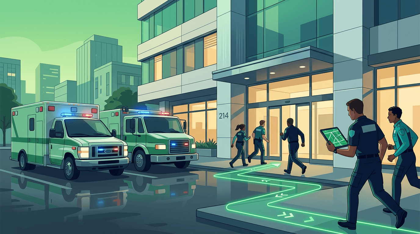
Ambulance & EMS
The clock runs until the crew is with the patient — not until the vehicle stops. Stairs, elevators, barriers, and long hallways aren’t edge cases; they decide whether care starts in minutes or much later.
We model the route from curb to door and capture access context that generic navigation skips — so crews can plan the carry before unloading, and receiving hospitals get tighter ETAs when the handover depends on building access.
Data keeps up as buildings change: new barriers, construction detours, temporary entrances — closing the gap between “what the map says” and “what the crew sees.”
A short walk on paper can be an impossible carry on site. Happypath exposes those differences as structured data — not as informal knowledge that drifts between shifts.
Approach
Where the vehicle should actually stop for fastest patient access.
Path
Walking route with practical constraints for stretchers and crews.
Access
Intercoms, elevator banks, and door systems that affect time-to-patient.
Fire, police, and EMS rarely need the same tactical detail — but all three need a truthful picture of how to reach the right place fast. Happypath builds a durable, reusable foundation that plugs into CAD workflows, pre-plans, and training — not a sketch that lives only on one whiteboard.
If your agency or region is evaluating modern location data for complex structures, we can walk through integration paths and governance — for fire, police, and EMS together or separately.